
Scientists and local authorities had been tracking the eruption’s precursors for weeks and evacuated residents. Then the magma stalled.
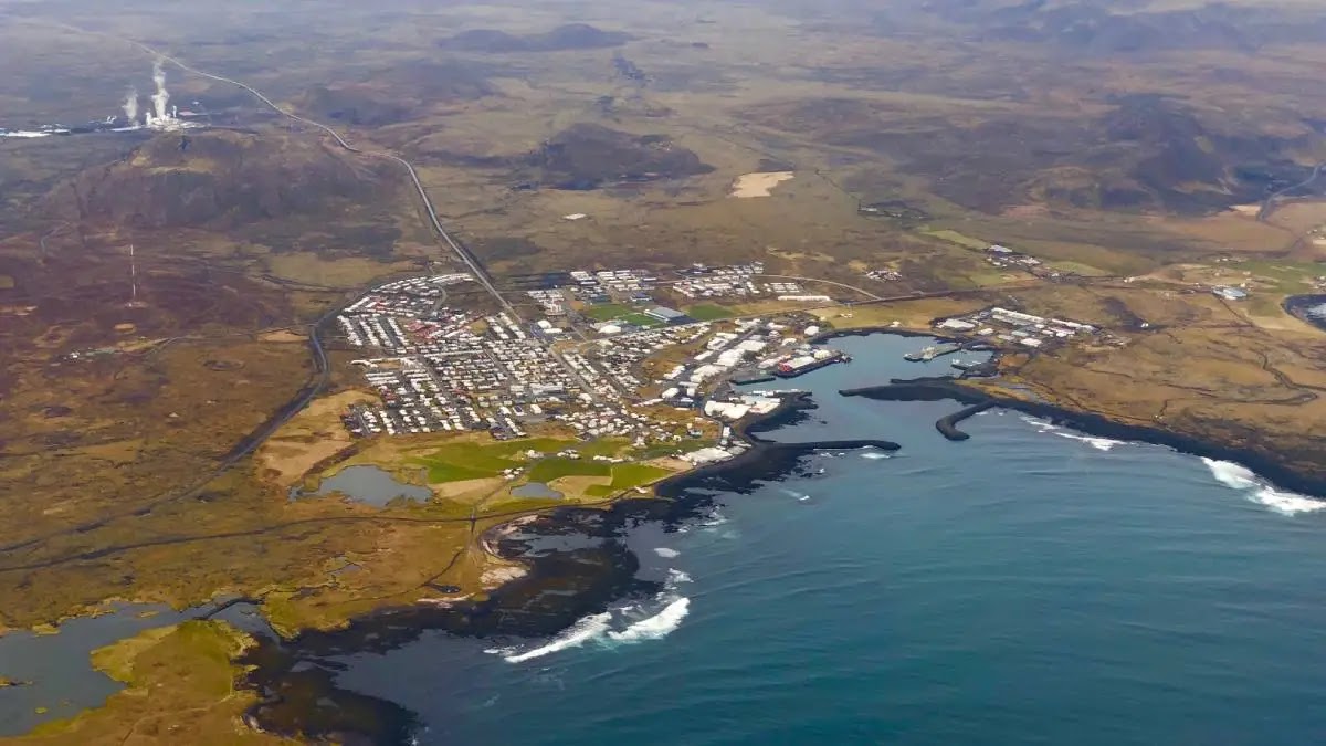
For weeks, scientists and officials anticipated the eruption of a volcanic fissure near Grindavík, a city of about 3,300 along the southern coast of Iceland’s Reykjanes Peninsula. An extended swarm of seismic activity and ground uplift slowly ramped up and then accelerated, prompting authorities to evacuate Grindavík’s residents, pets, and livestock.
However, after a tense waiting period, the frequency and strength of seismic activity decreased, and uplift slowed. The latest data suggest that magma inflow into the fissure has significantly slowed. The possibility of an eruption along the fissure is decreasing, but the risk is not completely gone, according to the Icelandic Meteorological Office (IMO).
If the fissure erupts, IMO models predict it will be east of Sýlingarfell, about 5 kilometers north of Grindavík.
This is the latest activity from the Fagradalsfjall volcano complex, which has experienced three major eruptions in the past 3 years. It last saw an eruption in July, when a fissure opened just over 14 kilometers to the northeast. That event lasted for 3 weeks, spewing 1.5 square kilometers of magma to the surface and igniting moss throughout the volcanic field. The July eruption, and fissure events in 2021 and 2022, occurred in remote parts of the Reykjanes Peninsula.
The rapid evolution of this fissure and its proximity to a populated area spurred fears that this eruption would be far worse than before. Despite the lack of eruption this time, the high rate of quakes and ground deformation damaged roads, buildings, and underground pipes in Grindavík.
On 24 October, seismometers reported a swarm of earthquakes centered just north of Grindavík. The quakes, the strongest of which was magnitude 4.5, occurred 2–6 kilometers below the surface. The swarm resurged on 30 October near Þorbjörn, which was “a clear sign of magma movements at depth,” IMO reported. Tens of thousands of quakes have occurred since 24 October.
Shortly after, continuous GPS measurements and interferometric synthetic aperture radar (InSAR) images detected ground uplift near Svartsengi. IMO officials suspected the deformation was caused by a magmatic intrusion.
Thousands of small quakes shook the region each day. Continuous tracking of ground inflation suggested that magma was accumulating in a horizontal sill about 5 kilometers belowground, flowing at an average rate of 5 cubic meters per second.
The earthquake locations and uplift data from early November suggested that a 15-kilometer-long intrusion cuts across the northwestern corner of Grindavík, with magma flowing 800 meters below the surface.
Seismicity and ground deformation slowed through 13 November, suggesting that magma was traveling toward the surface, according to IMO. Satellite radar data showed a graben-like formation—an elongated section of crust lower than its surroundings—aligned with the dike and cutting through part of Grindavík. InSAR imagery revealed up to a meter of vertical ground displacement.
On 10 November, IMO reported that seismic activity and deformation “are similar to those seen on the eve of the first eruption at Fagradalsfjall in 2021.” The quakes moved south toward Grindavík, at which point authorities decided to evacuate the city—the evacuation took just 3.5 hours, according to RÚV English, Iceland’s national radio broadcasting service. A large fissure emerged within the town limits and swiftly grew along the surface.
Eruption Stalled
In mid-November, IMO scientists installed differential optical absorption spectrometers (DOAS) to detect magmatic outgassing and a fiber-optic cable to monitor seismic activity underground, hoping to spot the moment the eruption changed from likely to imminent.
Instead, these measurements and GPS monitoring of ground deformation showed a slowdown of eruption processes: Quakes became less frequent, ground uplift slowed, and magma inflow rates decreased. “As crustal relaxation continues to occur and seismicity decreases, along with a decrease in magma inflow to the intrusion, the likelihood of an imminent volcanic eruption diminishes with time,” IMO reported on 24 November.
Hundreds of small quakes continue to shake the region daily, and magma continues to slowly inflate the ground near Svartsengi. It’s still possible that the fissure could erupt, but scientists are using this reprieve to better understand how the magma dike evolved over the past weeks and the continued likelihood of an eruption.
Residents were briefly allowed back into the evacuated area to retrieve essential items, pets, and livestock (special operations were undertaken to retrieve horses) on 12 and 13 November. Photos and videos taken during that time revealed some of the preeruption damage to the town, including large cracks in pavement wafting steam from broken hot water pipes.